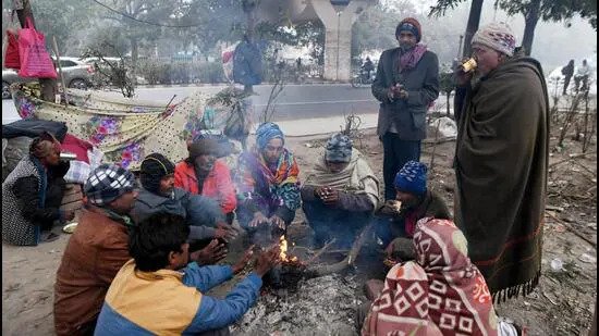
The biting cold conditions marked by low daytime temperatures will relent from northwest India Wednesday onwards, scientists of the India Meteorological Department (IMD) said, predicting respite at least till New Year’s Day.
The biting cold conditions marked by low daytime temperatures will relent from northwest India Wednesday onwards, scientists of the India Meteorological Department (IMD) said on Tuesday, predicting respite at least till New Year’s Day.
Temperatures plummeted to levels up to 11°C lower than usual for the daytime as blanket of fog settled over much of the Ingo-Gangetic plains, blocking out the sun, and disrupting rail, road and air traffic. Such conditions create what is known in meteorological parlance as a cold day.
“This was an intense and long spell of cold day, cold wave and dense fog conditions over a large region of northwest India. The situation has started improving from today (Tuesday). The dense fog spell over Punjab, Haryana, West UP started from December 19 and the cold day conditions started over the region from December 23 with very severe cold day conditions on December 25 and 26,” said RK Jenamani, senior scientist, national weather forecasting centre, IMD.
The worst of the fog, Jenamani said, came on the night of December 26 night when visibility was less than 50 meter over most parts of Punjab, Haryana, Delhi and west UP. “We are expecting a brief relief from these cold day and cold wave conditions as Western Disturbance is approaching the Western Himalayan region. The sunshine during the day time will also bring relief,” he explained.
But once the Western Disturbance, or moisture heavy, warmer winds sweeping in from over the middle east, passes, temperatures will fall once again, potentially triggering another cold snap. “The WD may bring light to moderate snowfall to Himachal Pradesh and Jammu and Kashmir. It will impact the most around December 29 and once it passes, cold will intensify once again since northwesterly winds bring cold air from the snowclad Himalayan region,” he added.
“We can expect a very brief respite with minimum and maximum temperatures likely to rise by 1-2°C. Around New Year’s Eve, extreme cold may not set in but temperatures will drop once again from January 1 or 2,” added a second expert, Mahesh Palawat, the vice president of climate and meteorology at Skymet Weather.
“The winds were west-north westerly but now they are north-north westerly, blowing at about 10 kmph over Delhi. A layer of upper haze when morning fog hasn’t lifted completely is also obscuring sunshine during the day giving a feel of biting cold. These conditions will last for a day before temperatures rise gradually,” Palawat had said on Monday.
But, Jenamani said the ‘feels like’ temperature during daytime may continue to be low because of north northwesterly cold winds blowing over the region, including Delhi-NCR.
In addition to day temperatures, nights – represented by the minimum temperature – too have been cold. This indicator was in the range of 3-7°C over many parts of Punjab, Haryana, Chandigarh, Delhi, Rajasthan, West Uttar Pradesh and adjoining northwest Madhya Pradesh.
Dense to very dense fog affected most parts of Punjab, Haryana, Chandigarh, Delhi and north Rajasthan, IMD data showed.
Due to prevailing light wind and high moisture in lower tropospheric levels, dense to very dense fog is very likely to continue over many parts of Haryana, Chandigarh and Delhi, West Uttar Pradesh and in isolated pockets over north Rajasthan in the next 24 hours, the IMD predicted.
Cold wave or severe cold wave conditions are very likely in isolated pockets over north Rajasthan during next 2 days and cold wave conditions are likely in isolated pockets over Punjab, Haryana-Chandigarh-Delhi during in the next 24 hours, the agency added.
In the plains, IMD declares a cold wave if the minimum temperature dips to 4°C. A cold wave is also declared when the minimum is 10°C or lower, and is 4.5 notches below normal. A severe cold wave is when the minimum temperature dips to 2°C or the departure from normal is more than 6.4°C.
A cold day is when maximum temperature is less than 10°C over plains, and is 4.5-6.4°C below normal, and a severe cold day is when maximum temperature is over 6.5 degrees below normal.
The IMD has also issued impact-based warning, saying people in worst-hit parts of Punjab, Haryana, Chandigarh, Delhi and West Uttar Pradesh should guard against an increased likelihood of illnesses like the flu, seek help if they are shivering and stay indoors since prolonged exposure could lead to frostbite.


